Information
Gorno-Altaisk is the capital and the only city of the Altai Republic.
Founded: 1824
City status since: 1928
Previous names: Ulala, Oyrot-Tura
Population in 2020: 64,478 people (Russians -68%, Altaians – 22%, Kazakhs -2%, others – 8%)
Distance: to Moscow – 3,641 km, to the large Siberian city of Novosibirsk – 448 km, to the nearest railway station in Biysk city – 100 km, to the capital of the Altai krai, Barnaul – 260 km.
The time difference with Moscow is +4 hours, the local time offset relative to UTC + 7 hours.

Location
Gorno-Altaisk is located in a small intermountain basin in the northwestern part of the Altai mountains, almost in the center of Eurasia at an altitude of 270-305 meters above sea level. It is surrounded from the north and the south by the ridges of 400-600 meters high.
Climate
The climate is continental with hot summers and cold winters with sometimes warmer days (even + zero). The hottest month is July, with an average temperature of +17 °C, and a maximum of +36.8 °C. The coldest month -January, has an average temperature of 16,1 °C, and a minimum of -49 °C.

History
People inhabited this territory since ancient times, but written references to a permanent settlement date back only to the beginning of the 19th century.
After voluntary annexation of Altai to the Russian Empire in 1756, Russians began to settle here. By 1810 several Russian villages – Srostki, Berezovka, Setovka – were founded close to the territory of modern Gorno-Altaisk. In 1811 Russian peasants reached the Maima river mouth and founded the village Maima-Chergachak. At that time the local nomadic tribe of Teleut had their pastures in this area. The Teleut did not have a tradition of settled housing, they were nomadic herders – the tradition of settled lifestyle was brought to the region by Russians.
In 1831, the Russian Orthodox church sent missionaries to Altai, whose goal it was to convert the local population to Christianity. They chose a nice green valley several kilometers from Maima for building a church and founding a mission site. The mission settlement got the name Ulala. It can be translated either as a big valley or a big village. In 1838 a small wooden church was built and missionaries started their activity. They allowed only baptized locals to settle down in this area. By 1860 the population grew up to 500 people and Ulala became the center of the missionary activity.
Soon after the missionaries, Biysk merchants came to the village, interested in expanding trade relations with Mongolia and China. Due to this combination of circumstances, Ulala grew rapidly – by the end of the 19th century, there were already 131 houses of baptized Altai people, 149 houses of Russian immigrants, a missionary school, an icon painting class, the first hospital in the region and 27 craft workshops. Altai began to attract more and more attention from scientists and merchants – several inns and the first hotel were opened for visitors.
By 1910, there were already 3 churches in Ulala, furthermore 2 schools and 500 houses with a population of 3,127 people. The village was gradually turning into a large commercial and cultural center.
Due to the Revolution of 1917, the development of Ulala slowed down, power in the region repeatedly passed from hand to hand, and only in 1922 the Soviet regime was finally established here. Ulala became the center of the newly formed autonomous Oirot region. In 1928, the village received the status of a city. Later, in 1932 the name Ulala was changed to Oirot-Tura, which was translated as “Oirot (endonym of local people) house”. During this period, administrative buildings, shops, schools and hospitals were built in the city, the Oirot Regional Museum of Local Lore and the Regional Drama Theater opened the doors for guests.
During the Second World War, the Moscow Pedagogical Institute, the Leningrad flight school, an orphanage and several industrial enterprises were evacuated to Oirot-Tura. Some of them continued their work in the city after the end of the war.
In 1948, the Oirot-Tura Autonomous Region was renamed to Gorno-Altai Autonomous Region, and the city received a new name too – Gorno-Altaisk. Over the next decades, active construction was underway here, and new city districts appeared. The industrial development took place mostly in so-called “light industries” – weaving, furniture and clothing factories were opened.
In 1992, after the Soviet Union had collapsed, the Gorno-Altai Autonomous Oblast received the status of a republic, and Gorno-Altaisk became the capital of the Altai Republic. In 1996, the emblem of the city was designed.
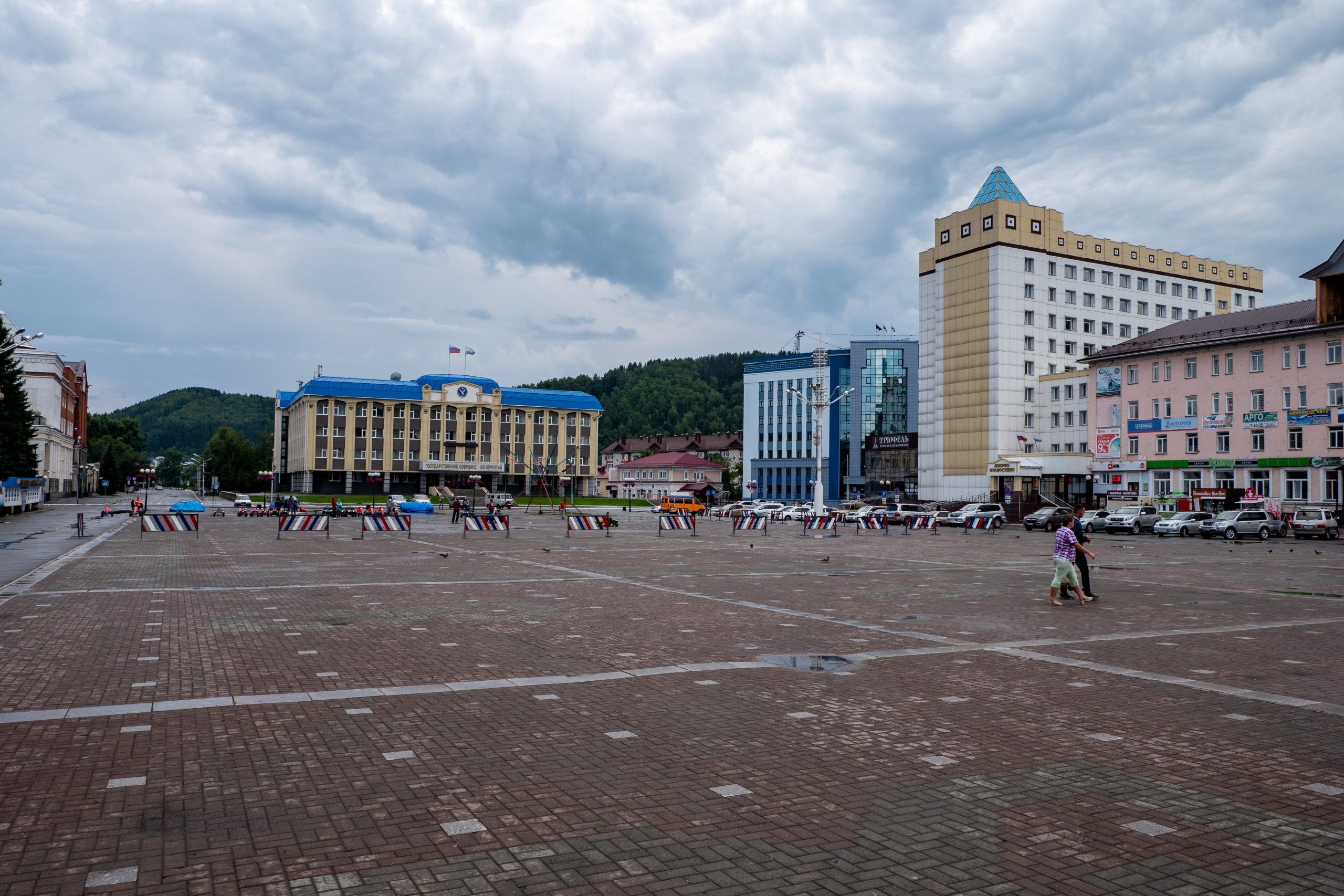
Today’s Gorno-Altaisk concentrates the region’s main cultural, scientific and industrial potential. The Gorno-Altaisk State University, several professional educational institutions, research institutes, the National Library of the Altai Republic, and the city cultural center are located here.
The main street is Kommunistichesky Avenue, which is also the longest street in the city.
By bus the city is connected with almost all large villages of the Republic and the nearest cities of Siberia. In 2011, after the reconstruction of the airport, regular flights to Moscow were established.
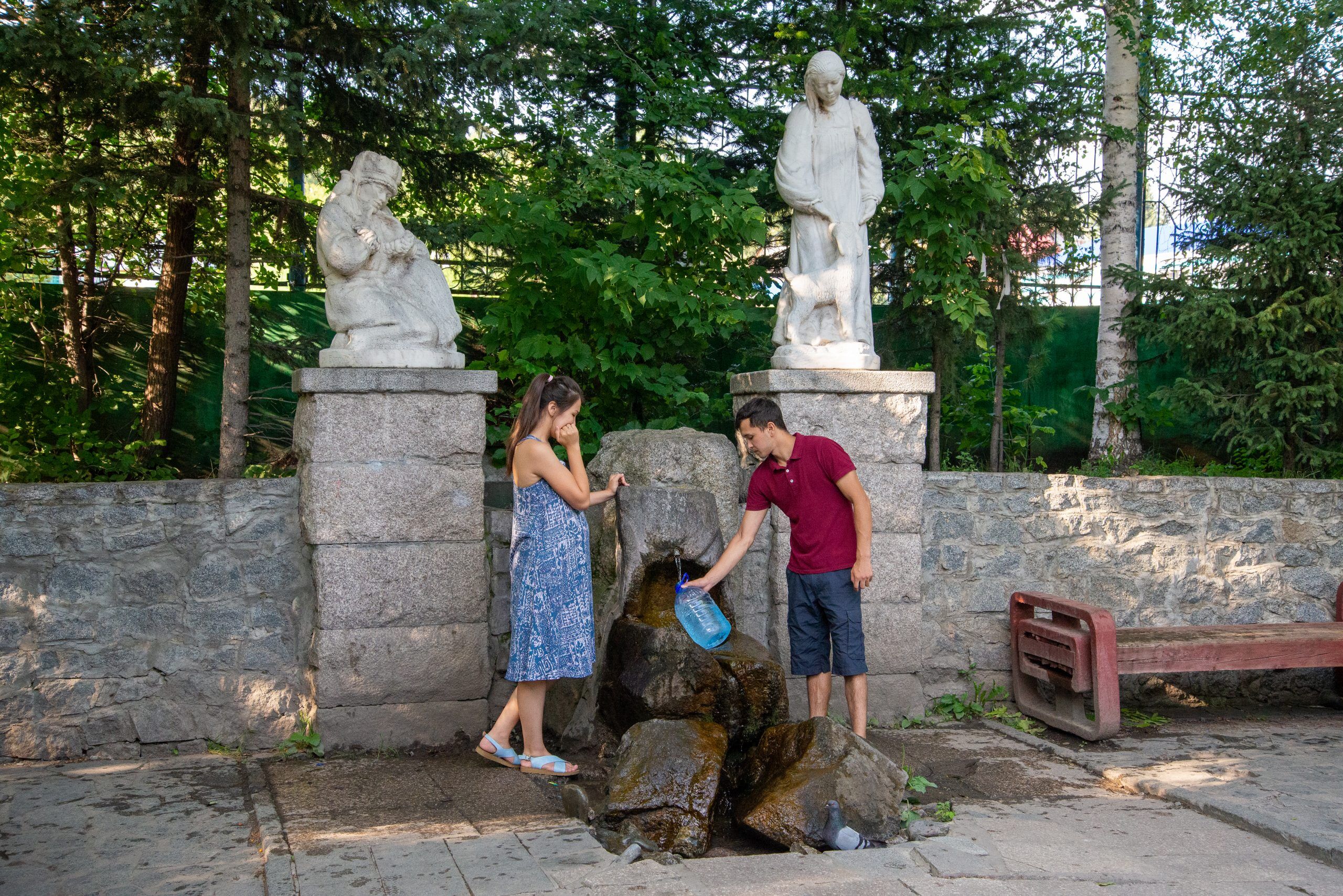
The city’s attractions:
- National Museum of the Altai Republic named after A.V. Anokhin
- City park of culture and leisure
- Park named after V.I. Lenin
- Observation platforms on Mount Komsomolskaya and Mount Tugaya;
- Victory Park
- Monument G.I. Choros-Gurkin
- National Drama Theater
- St. Makaryevsky temple.
Information
Gorno-Altaisk is the capital and the only city of the Altai Republic.
Founded: 1824
City status since: 1928
Previous names: Ulala, Oyrot-Tura
Population in 2020: 64,478 people (Russians -68%, Altaians – 22%, Kazakhs -2%, others – 8%)
Distance: to Moscow – 3,641 km, to the large Siberian city of Novosibirsk – 448 km, to the nearest railway station in Biysk city – 100 km, to the capital of the Altai krai, Barnaul – 260 km.
The time difference with Moscow is +4 hours, the local time offset relative to UTC + 7 hours.
Location
Gorno-Altaisk is located in a small intermountain basin in the northwestern part of the Altai mountains, almost in the center of Eurasia at an altitude of 270-305 meters above sea level. It is surrounded from the north and the south by the ridges of 400-600 meters high.
Climate
The climate is continental with hot summers and cold winters with sometimes warmer days (even + zero). The hottest month is July, with an average temperature of +17 °C, and a maximum of +36.8 °C. The coldest month -January, has an average temperature of 16,1 °C, and a minimum of -49 °C.
History
People inhabited this territory since ancient times, but written references to a permanent settlement date back only to the beginning of the 19th century.
After voluntary annexation of Altai to the Russian Empire in 1756, Russians began to settle here. By 1810 several Russian villages – Srostki, Berezovka, Setovka – were founded close to the territory of modern Gorno-Altaisk. In 1811 Russian peasants reached the Maima river mouth and founded the village Maima-Chergachak. At that time the local nomadic tribe of Teleut had their pastures in this area. The Teleut did not have a tradition of settled housing, they were nomadic herders – the tradition of settled lifestyle was brought to the region by Russians.
In 1831, the Russian Orthodox church sent missionaries to Altai, whose goal it was to convert the local population to Christianity. They chose a nice green valley several kilometers from Maima for building a church and founding a mission site. The mission settlement got the name Ulala. It can be translated either as a big valley or a big village. In 1838 a small wooden church was built and missionaries started their activity. They allowed only baptized locals to settle down in this area. By 1860 the population grew up to 500 people and Ulala became the center of the missionary activity.
Soon after the missionaries, Biysk merchants came to the village, interested in expanding trade relations with Mongolia and China. Due to this combination of circumstances, Ulala grew rapidly – by the end of the 19th century, there were already 131 houses of baptized Altai people, 149 houses of Russian immigrants, a missionary school, an icon painting class, the first hospital in the region and 27 craft workshops. Altai began to attract more and more attention from scientists and merchants – several inns and the first hotel were opened for visitors.
By 1910, there were already 3 churches in Ulala, furthermore 2 schools and 500 houses with a population of 3,127 people. The village was gradually turning into a large commercial and cultural center.
Due to the Revolution of 1917, the development of Ulala slowed down, power in the region repeatedly passed from hand to hand, and only in 1922 the Soviet regime was finally established here. Ulala became the center of the newly formed autonomous Oirot region. In 1928, the village received the status of a city. Later, in 1932 the name Ulala was changed to Oirot-Tura, which was translated as “Oirot (endonym of local people) house”. During this period, administrative buildings, shops, schools and hospitals were built in the city, the Oirot Regional Museum of Local Lore and the Regional Drama Theater opened the doors for guests.
During the Second World War, the Moscow Pedagogical Institute, the Leningrad flight school, an orphanage and several industrial enterprises were evacuated to Oirot-Tura. Some of them continued their work in the city after the end of the war.
In 1948, the Oirot-Tura Autonomous Region was renamed to Gorno-Altai Autonomous Region, and the city received a new name too – Gorno-Altaisk. Over the next decades, active construction was underway here, and new city districts appeared. The industrial development took place mostly in so-called “light industries” – weaving, furniture and clothing factories were opened.
In 1992, after the Soviet Union had collapsed, the Gorno-Altai Autonomous Oblast received the status of a republic, and Gorno-Altaisk became the capital of the Altai Republic. In 1996, the emblem of the city was designed.
Today’s Gorno-Altaisk concentrates the region’s main cultural, scientific and industrial potential. The Gorno-Altaisk State University, several professional educational institutions, research institutes, the National Library of the Altai Republic, and the city cultural center are located here.
The main street is Kommunistichesky Avenue, which is also the longest street in the city.
By bus the city is connected with almost all large villages of the Republic and the nearest cities of Siberia. In 2011, after the reconstruction of the airport, regular flights to Moscow were established.
The city’s attractions:
- National Museum of the Altai Republic named after A.V. Anokhin
- City park of culture and leisure
- Park named after V.I. Lenin
- Observation platforms on Mount Komsomolskaya and Mount Tugaya;
- Victory Park
- Monument G.I. Choros-Gurkin
- National Drama Theater
- St. Makaryevsky temple.
Kaichi Travel
Adventure travel, nature tours to Altai – one of the most beautiful places in Siberia.
© 2018 by Kaichi Travel Privacy Policy Cookie Policy Booking Terms & Conditions
Info
Our tours
Follow us
tel.: +31 645466537
e-mail: [email protected]